
江永县 topographic map
Interactive map
Click on the map to display elevation.
About this map
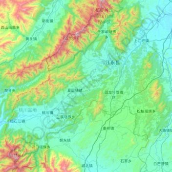
Name: 江永县 topographic map, elevation, terrain.
Location: 江永县, 永州市, 湖南省, 425400, 中国 (24.91653 110.94618 25.47882 111.54509)
Average elevation: 491 m
Minimum elevation: 183 m
Maximum elevation: 1,873 m
北部为都庞岭,最高海拔1951米(杉木顶)。
Other topographic maps
Click on a map to view its topography, its elevation and its terrain.