
兴隆村 topographic map
Interactive map
Click on the map to display elevation.
About this map
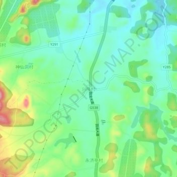
Name: 兴隆村 topographic map, elevation, terrain.
Location: 兴隆村, 回龙圩镇, 回龙圩管理区, 江永县, 永州市, 湖南省, 中国 (25.11698 111.30872 25.15698 111.34872)
Average elevation: 391 m
Minimum elevation: 344 m
Maximum elevation: 497 m