Geolocate

洋市镇 topographic map

Interactive map

Click on the map to display elevation.

About this map

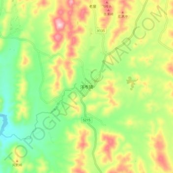
Name: 洋市镇 topographic map, elevation, terrain.

Location: 洋市镇, 桂阳县, 郴州市, 湖南省, 中国 (25.91411 112.75482 25.99411 112.83482)

Average elevation: 261 m

Minimum elevation: 117 m

Maximum elevation: 458 m

Other topographic maps

Click on a map to view its topography, its elevation and its terrain.

太坪头

中国 > 湖南省 > 桂阳县

太坪头, 桂阳县, 郴州市, 湖南省, 中国

Average elevation: 375 m

东塔岭

中国 > 湖南省 > 桂阳县 > 鹿峰街道

东塔岭, 鹿峰街道, 桂阳县, 郴州市, 湖南省, 中国

Average elevation: 306 m

桂阳县

中国 > 湖南省 > 桂阳县

桂阳县, 郴州市, 湖南省, 424400, 中国

Average elevation: 302 m

刘家寨

中国 > 湖南省 > 桂阳县 > 鹿峰街道 > 牛巷口

刘家寨, 牛巷口, 鹿峰街道, 桂阳县, 郴州市, 湖南省, 中国

Average elevation: 280 m

方元镇

中国 > 湖南省 > 桂阳县

方元镇, 桂阳县, 郴州市, 湖南省, 中国

Average elevation: 353 m