
黄市镇 topographic map
Interactive map
Click on the map to display elevation.
About this map
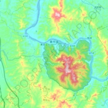
Name: 黄市镇 topographic map, elevation, terrain.
Location: 黄市镇, 耒阳市, 衡阳市, 湖南省, 421800, 中国 (26.15580 112.87227 26.28512 113.03291)
Average elevation: 199 m
Minimum elevation: 79 m
Maximum elevation: 526 m
Other topographic maps
Click on a map to view its topography, its elevation and its terrain.