
洞阳镇 topographic map
Interactive map
Click on the map to display elevation.
About this map
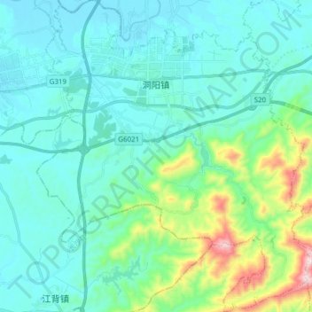
Name: 洞阳镇 topographic map, elevation, terrain.
Location: 洞阳镇, 浏阳市, 长沙市, 湖南省, 中国 (28.11555 113.34089 28.25023 113.47571)
Average elevation: 169 m
Minimum elevation: 48 m
Maximum elevation: 749 m
Other topographic maps
Click on a map to view its topography, its elevation and its terrain.