
大围山镇 topographic map
Interactive map
Click on the map to display elevation.
About this map
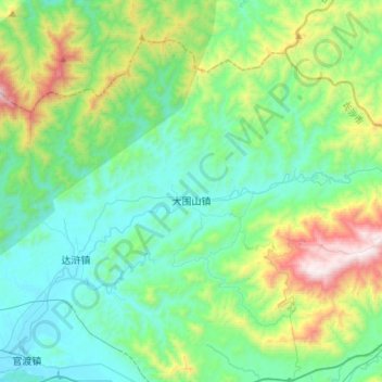
Name: 大围山镇 topographic map, elevation, terrain.
Location: 大围山镇, 浏阳市, 长沙市, 湖南省, 中国 (28.36157 113.91863 28.56820 114.21443)
Average elevation: 436 m
Minimum elevation: 98 m
Maximum elevation: 1,561 m
Other topographic maps
Click on a map to view its topography, its elevation and its terrain.