
万佛山镇 topographic map
Interactive map
Click on the map to display elevation.
About this map
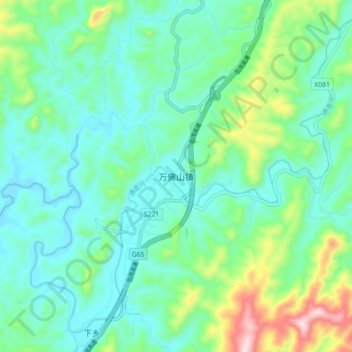
Name: 万佛山镇 topographic map, elevation, terrain.
Location: 万佛山镇, 通道侗族自治县, 怀化市, 湖南省, 中国 (26.20860 109.82000 26.28860 109.90000)
Average elevation: 453 m
Minimum elevation: 359 m
Maximum elevation: 762 m
Other topographic maps
Click on a map to view its topography, its elevation and its terrain.