
白水镇 topographic map
Interactive map
Click on the map to display elevation.
About this map
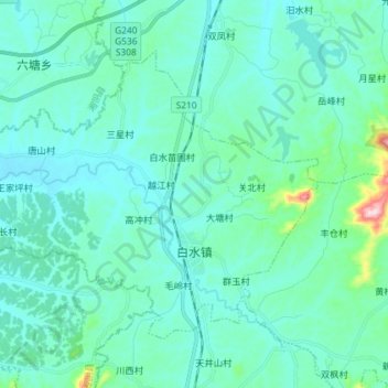
Name: 白水镇 topographic map, elevation, terrain.
Location: 白水镇, 汨罗市, 岳阳市, 湖南省, 中国 (28.63622 112.94818 28.73098 113.09335)
Average elevation: 77 m
Minimum elevation: 35 m
Maximum elevation: 365 m
Other topographic maps
Click on a map to view its topography, its elevation and its terrain.