
㮾梨街道 topographic map
Interactive map
Click on the map to display elevation.
About this map
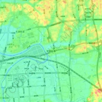
Name: 㮾梨街道 topographic map, elevation, terrain.
Location: 㮾梨街道, 长沙县, 长沙市, 湖南省, 中国 (28.13898 113.09601 28.22084 113.16729)
Average elevation: 44 m
Minimum elevation: 24 m
Maximum elevation: 86 m