
九里堤街道 topographic map
Interactive map
Click on the map to display elevation.
About this map
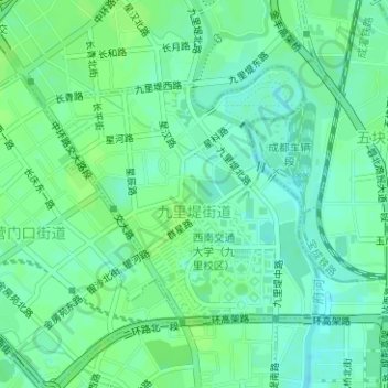
Name: 九里堤街道 topographic map, elevation, terrain.
Location: 九里堤街道, 金牛区, 成都市, 四川省, 中国 (30.69685 104.03607 30.71461 104.05827)
Average elevation: 507 m
Minimum elevation: 501 m
Maximum elevation: 511 m
Other topographic maps
Click on a map to view its topography, its elevation and its terrain.