
东湖街道 topographic map
Interactive map
Click on the map to display elevation.
About this map
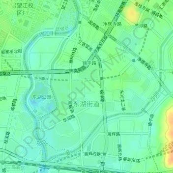
Name: 东湖街道 topographic map, elevation, terrain.
Location: 东湖街道, 锦江区, 成都市, 四川省, 中国 (30.60907 104.08196 30.63251 104.10667)
Average elevation: 490 m
Minimum elevation: 479 m
Maximum elevation: 512 m
Other topographic maps
Click on a map to view its topography, its elevation and its terrain.