
成飞公园 topographic map
Interactive map
Click on the map to display elevation.
About this map
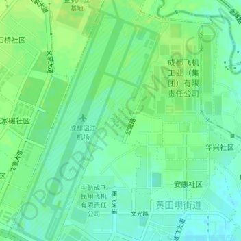
Name: 成飞公园 topographic map, elevation, terrain.
Location: 成飞公园, 黄田坝街道, 青羊区, 成都市, 高新区(西区), 四川省, 中国 (30.70033 103.95287 30.70431 103.95634)
Average elevation: 518 m
Minimum elevation: 511 m
Maximum elevation: 524 m
Other topographic maps
Click on a map to view its topography, its elevation and its terrain.