
彬州市 topographic map
Interactive map
Click on the map to display elevation.
About this map
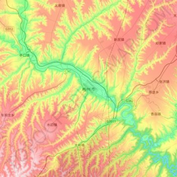
Name: 彬州市 topographic map, elevation, terrain.
Location: 彬州市, 咸阳市, 陕西省, 中国 (34.87629 107.91976 35.19629 108.23976)
Average elevation: 1,082 m
Minimum elevation: 741 m
Maximum elevation: 1,441 m
Other topographic maps
Click on a map to view its topography, its elevation and its terrain.