
火烧店镇 topographic map
Interactive map
Click on the map to display elevation.
About this map
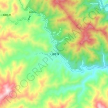
Name: 火烧店镇 topographic map, elevation, terrain.
Location: 火烧店镇, 留坝县, 汉中市, 陕西省, 中国 (33.50029 106.87252 33.58029 106.95252)
Average elevation: 1,154 m
Minimum elevation: 803 m
Maximum elevation: 1,699 m
Other topographic maps
Click on a map to view its topography, its elevation and its terrain.