
张洪镇 topographic map
Interactive map
Click on the map to display elevation.
About this map
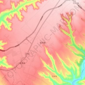
Name: 张洪镇 topographic map, elevation, terrain.
Location: 张洪镇, 咸阳市, 陕西省, 中国 (35.00996 108.20660 35.08996 108.28660)
Average elevation: 1,133 m
Minimum elevation: 896 m
Maximum elevation: 1,215 m
Other topographic maps
Click on a map to view its topography, its elevation and its terrain.