
曲江池遗址公园 topographic map
Interactive map
Click on the map to display elevation.
About this map
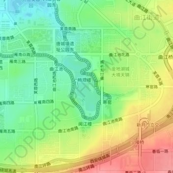
Name: 曲江池遗址公园 topographic map, elevation, terrain.
Location: 曲江池遗址公园, 曲江街道, 雁塔区, 西安市, 陕西省, 中国 (34.19655 108.97405 34.20652 108.98463)
Average elevation: 463 m
Minimum elevation: 427 m
Maximum elevation: 508 m
Other topographic maps
Click on a map to view its topography, its elevation and its terrain.