
华县 topographic map
Interactive map
Click on the map to display elevation.
About this map
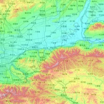
Name: 华县 topographic map, elevation, terrain.
Location: 华县, 陕西省, 中国 (33.74889 109.04556 35.14889 110.44556)
Average elevation: 828 m
Minimum elevation: 320 m
Maximum elevation: 2,725 m
Other topographic maps
Click on a map to view its topography, its elevation and its terrain.