
正阳镇 topographic map
Interactive map
Click on the map to display elevation.
About this map
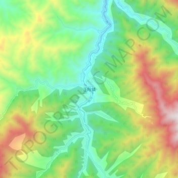
Name: 正阳镇 topographic map, elevation, terrain.
Location: 正阳镇, 安康市, 陕西省, 中国 (31.99047 109.13728 32.07047 109.21728)
Average elevation: 1,450 m
Minimum elevation: 904 m
Maximum elevation: 2,441 m
Other topographic maps
Click on a map to view its topography, its elevation and its terrain.