
中山区 topographic map
Interactive map
Click on the map to display elevation.
About this map
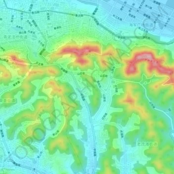
Name: 中山区 topographic map, elevation, terrain.
Location: 中山区, 大连市, 辽宁省, 160013, 中国 (38.88171 121.64958 38.92171 121.68958)
Average elevation: 57 m
Minimum elevation: -1 m
Maximum elevation: 202 m
Other topographic maps
Click on a map to view its topography, its elevation and its terrain.