
鞍山市 topographic map
Interactive map
Click on the map to display elevation.
About this map
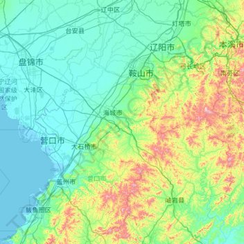
Name: 鞍山市 topographic map, elevation, terrain.
Location: 鞍山市, 辽宁省, 中国 (39.99865 122.18702 41.56818 123.76188)
Average elevation: 145 m
Minimum elevation: -2 m
Maximum elevation: 1,111 m
Other topographic maps
Click on a map to view its topography, its elevation and its terrain.