
双岭村 topographic map
Interactive map
Click on the map to display elevation.
About this map
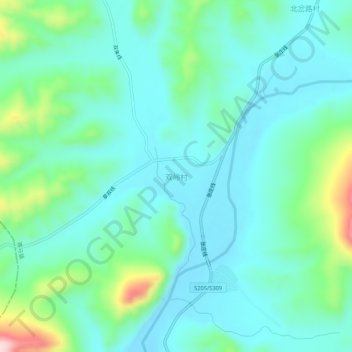
Name: 双岭村 topographic map, elevation, terrain.
Location: 双岭村, 凤城市, 丹东市, 辽宁省, 中国 (40.87847 124.14766 40.91847 124.18766)
Average elevation: 250 m
Minimum elevation: 187 m
Maximum elevation: 482 m
Other topographic maps
Click on a map to view its topography, its elevation and its terrain.