
郭家村 topographic map
Interactive map
Click on the map to display elevation.
About this map
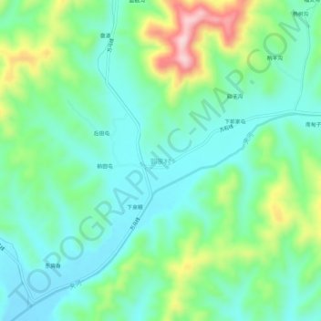
Name: 郭家村 topographic map, elevation, terrain.
Location: 郭家村, 庄河市, 大连市, 辽宁省, 中国 (39.76917 122.58573 39.80917 122.62573)
Average elevation: 133 m
Minimum elevation: 58 m
Maximum elevation: 326 m
Other topographic maps
Click on a map to view its topography, its elevation and its terrain.