
九连城镇 topographic map
Interactive map
Click on the map to display elevation.
About this map
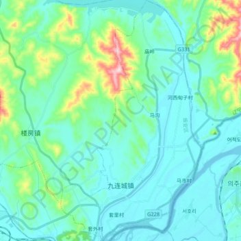
Name: 九连城镇 topographic map, elevation, terrain.
Location: 九连城镇, 振安区, 丹东市, 辽宁省, 118000, 中国 (40.16784 124.41257 40.29160 124.50789)
Average elevation: 58 m
Minimum elevation: -1 m
Maximum elevation: 342 m
Other topographic maps
Click on a map to view its topography, its elevation and its terrain.