
南山村 topographic map
Interactive map
Click on the map to display elevation.
About this map
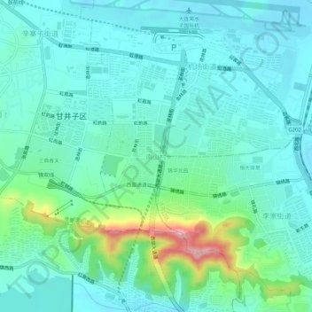
Name: 南山村 topographic map, elevation, terrain.
Location: 南山村, 甘井子区, 大连市, 辽宁省, 116033, 中国 (38.92546 121.51375 38.96546 121.55375)
Average elevation: 63 m
Minimum elevation: 20 m
Maximum elevation: 235 m
Other topographic maps
Click on a map to view its topography, its elevation and its terrain.