
绍濂乡 topographic map
Interactive map
Click on the map to display elevation.
About this map
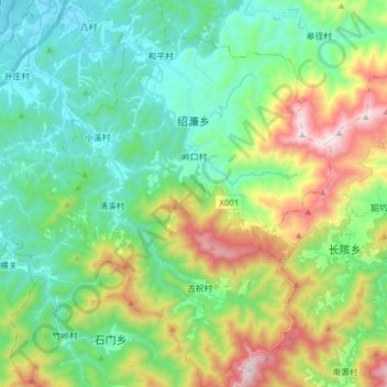
Name: 绍濂乡 topographic map, elevation, terrain.
Location: 绍濂乡, 歙县, 黄山市, 安徽省, 中国 (29.61183 118.41029 29.74761 118.51943)
Average elevation: 436 m
Minimum elevation: 113 m
Maximum elevation: 1,199 m
Other topographic maps
Click on a map to view its topography, its elevation and its terrain.