
北岸镇 topographic map
Interactive map
Click on the map to display elevation.
About this map
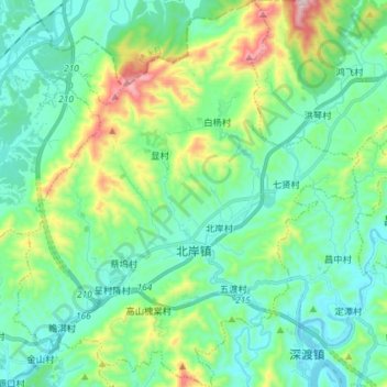
Name: 北岸镇 topographic map, elevation, terrain.
Location: 北岸镇, 歙县, 黄山市, 安徽省, 中国 (29.85700 118.49892 29.98291 118.62876)
Average elevation: 243 m
Minimum elevation: 97 m
Maximum elevation: 722 m
Other topographic maps
Click on a map to view its topography, its elevation and its terrain.