
深渡镇 topographic map
Interactive map
Click on the map to display elevation.
About this map
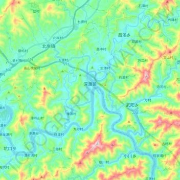
Name: 深渡镇 topographic map, elevation, terrain.
Location: 深渡镇, 歙县, 黄山市, 安徽省, 中国 (29.78197 118.53093 29.94222 118.66691)
Average elevation: 260 m
Minimum elevation: 91 m
Maximum elevation: 770 m
Other topographic maps
Click on a map to view its topography, its elevation and its terrain.