
太龙镇 topographic map
Interactive map
Click on the map to display elevation.
About this map
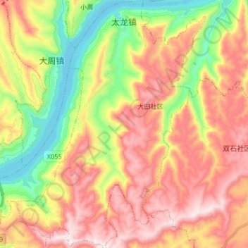
Name: 太龙镇 topographic map, elevation, terrain.
Location: 太龙镇, 万州区, 重庆市, 中国 (30.80211 108.47848 30.91521 108.57961)
Average elevation: 453 m
Minimum elevation: 91 m
Maximum elevation: 810 m
Other topographic maps
Click on a map to view its topography, its elevation and its terrain.