
太原镇 topographic map
Interactive map
Click on the map to display elevation.
About this map
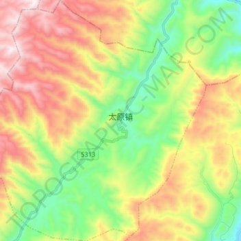
Name: 太原镇 topographic map, elevation, terrain.
Location: 太原镇, 彭水苗族土家族自治县, 重庆市, 中国 (29.64062 108.19148 29.75421 108.32133)
Average elevation: 1,110 m
Minimum elevation: 564 m
Maximum elevation: 1,834 m
Other topographic maps
Click on a map to view its topography, its elevation and its terrain.