
呈坎村 topographic map
Interactive map
Click on the map to display elevation.
About this map
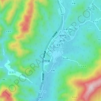
Name: 呈坎村 topographic map, elevation, terrain.
Location: 呈坎村, 黄山市, 安徽省, 中国 (29.90172 118.25618 29.94172 118.29618)
Average elevation: 290 m
Minimum elevation: 176 m
Maximum elevation: 612 m
Other topographic maps
Click on a map to view its topography, its elevation and its terrain.