
金佛山 topographic map
Interactive map
Click on the map to display elevation.
About this map
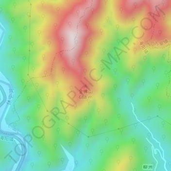
Name: 金佛山 topographic map, elevation, terrain.
Location: 金佛山, 黄山市, 安徽省, 中国 (29.85337 118.16998 29.85347 118.17008)
Average elevation: 414 m
Minimum elevation: 166 m
Maximum elevation: 779 m
Other topographic maps
Click on a map to view its topography, its elevation and its terrain.