
红旗岭 topographic map
Interactive map
Click on the map to display elevation.
About this map
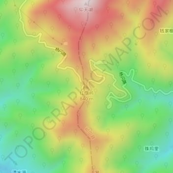
Name: 红旗岭 topographic map, elevation, terrain.
Location: 红旗岭, 黄山市, 安徽省, 中国 (29.96505 117.19966 29.96515 117.19976)
Average elevation: 709 m
Minimum elevation: 383 m
Maximum elevation: 1,093 m
Other topographic maps
Click on a map to view its topography, its elevation and its terrain.