
黟县 topographic map
Interactive map
Click on the map to display elevation.
About this map
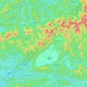
Name: 黟县 topographic map, elevation, terrain.
Location: 黟县, 黄山市, 安徽省, 中国 (29.79145 117.64432 30.19528 118.10120)
Average elevation: 399 m
Minimum elevation: 104 m
Maximum elevation: 1,600 m
Other topographic maps
Click on a map to view its topography, its elevation and its terrain.