
阳湖镇 topographic map
Interactive map
Click on the map to display elevation.
About this map
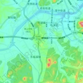
Name: 阳湖镇 topographic map, elevation, terrain.
Location: 阳湖镇, 屯溪区, 黄山市, 安徽省, 245000, 中国 (29.65723 118.28809 29.71582 118.35734)
Average elevation: 143 m
Minimum elevation: 116 m
Maximum elevation: 250 m
Other topographic maps
Click on a map to view its topography, its elevation and its terrain.