
塘厦镇 topographic map
Interactive map
Click on the map to display elevation.
About this map
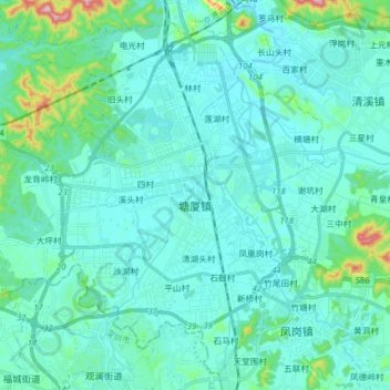
Name: 塘厦镇 topographic map, elevation, terrain.
Location: 塘厦镇, 东莞市, 广东省, 523710, 中国 (22.73359 113.98598 22.86703 114.14327)
Average elevation: 52 m
Minimum elevation: 11 m
Maximum elevation: 328 m
Other topographic maps
Click on a map to view its topography, its elevation and its terrain.