
巴彦托海镇 topographic map
Interactive map
Click on the map to display elevation.
About this map
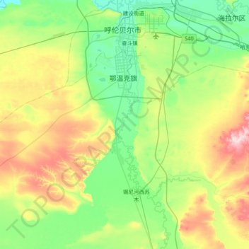
Name: 巴彦托海镇 topographic map, elevation, terrain.
Location: 巴彦托海镇, 鄂温克族自治旗, 呼伦贝尔市, 内蒙古自治区, 中国 (48.93360 119.54641 49.18419 120.18449)
Average elevation: 668 m
Minimum elevation: 596 m
Maximum elevation: 840 m
Other topographic maps
Click on a map to view its topography, its elevation and its terrain.