
敖鲁古雅乡 topographic map
Interactive map
Click on the map to display elevation.
About this map
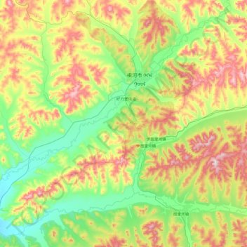
Name: 敖鲁古雅乡 topographic map, elevation, terrain.
Location: 敖鲁古雅乡, 根河市, 呼伦贝尔市, 内蒙古自治区, 中国 (50.40806 120.68292 50.95433 121.50109)
Average elevation: 848 m
Minimum elevation: 643 m
Maximum elevation: 1,248 m
Other topographic maps
Click on a map to view its topography, its elevation and its terrain.