
三岔河镇 topographic map
Interactive map
Click on the map to display elevation.
About this map
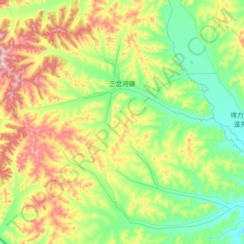
Name: 三岔河镇 topographic map, elevation, terrain.
Location: 三岔河镇, 阿荣旗, 呼伦贝尔市, 内蒙古自治区, 中国 (48.48395 123.20421 48.78349 123.71861)
Average elevation: 387 m
Minimum elevation: 253 m
Maximum elevation: 698 m
Other topographic maps
Click on a map to view its topography, its elevation and its terrain.