
鄂伦春自治旗 topographic map
Interactive map
Click on the map to display elevation.
About this map
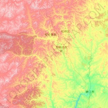
Name: 鄂伦春自治旗 topographic map, elevation, terrain.
Location: 鄂伦春自治旗, 呼伦贝尔市, 内蒙古自治区, 中国 (48.82377 121.73026 51.48042 125.32729)
Average elevation: 589 m
Minimum elevation: 201 m
Maximum elevation: 1,447 m
Other topographic maps
Click on a map to view its topography, its elevation and its terrain.