
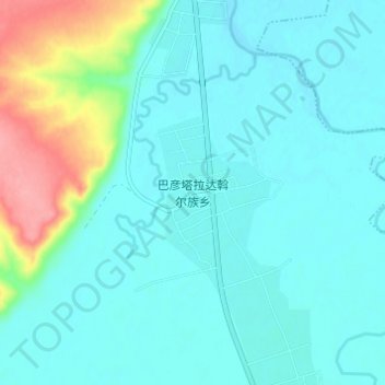
巴彦塔拉达斡尔族乡 topographic map
Interactive map
Click on the map to display elevation.
About this map
Name: 巴彦塔拉达斡尔族乡 topographic map, elevation, terrain.
Location: 巴彦塔拉达斡尔族乡, 呼伦贝尔市, 内蒙古自治区, 中国 (48.99640 119.70600 49.03640 119.74600)
Average elevation: 641 m
Minimum elevation: 623 m
Maximum elevation: 717 m
Other topographic maps
Click on a map to view its topography, its elevation and its terrain.