
伍隍镇 topographic map
Interactive map
Click on the map to display elevation.
About this map
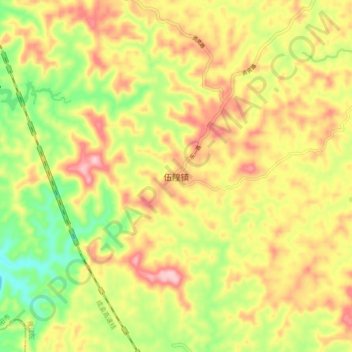
Name: 伍隍镇 topographic map, elevation, terrain.
Location: 伍隍镇, 雁江区, 资阳市, 四川省, 中国 (29.92855 104.74198 30.00855 104.82198)
Average elevation: 420 m
Minimum elevation: 326 m
Maximum elevation: 508 m
Other topographic maps
Click on a map to view its topography, its elevation and its terrain.