
龙门镇 topographic map
Interactive map
Click on the map to display elevation.
About this map
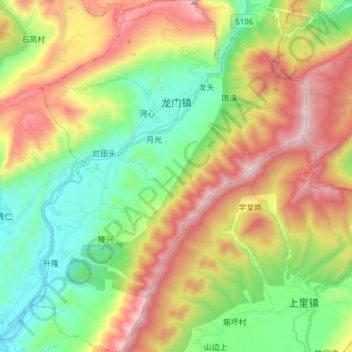
Name: 龙门镇 topographic map, elevation, terrain.
Location: 龙门镇, 芦山县, 雅安市, 四川省, 中国 (30.15957 102.95178 30.29279 103.07086)
Average elevation: 1,132 m
Minimum elevation: 676 m
Maximum elevation: 1,811 m
Other topographic maps
Click on a map to view its topography, its elevation and its terrain.