
枫顺乡 topographic map
Interactive map
Click on the map to display elevation.
About this map
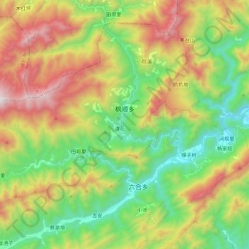
Name: 枫顺乡 topographic map, elevation, terrain.
Location: 枫顺乡, 江油市, 绵阳市, 四川省, 中国 (32.17590 104.92461 32.29141 105.09143)
Average elevation: 1,294 m
Minimum elevation: 668 m
Maximum elevation: 2,267 m
Other topographic maps
Click on a map to view its topography, its elevation and its terrain.