
德巫乡 topographic map
Interactive map
Click on the map to display elevation.
About this map
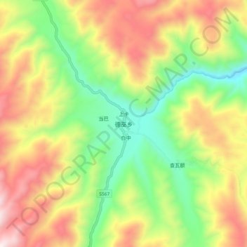
Name: 德巫乡 topographic map, elevation, terrain.
Location: 德巫乡, 理塘县, 甘孜藏族自治州, 四川省, 中国 (29.41538 100.54711 29.49538 100.62711)
Average elevation: 3,977 m
Minimum elevation: 3,490 m
Maximum elevation: 4,574 m
Other topographic maps
Click on a map to view its topography, its elevation and its terrain.