
大渡河金口大峡谷 topographic map
Interactive map
Click on the map to display elevation.
About this map
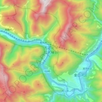
Name: 大渡河金口大峡谷 topographic map, elevation, terrain.
Location: 大渡河金口大峡谷, 乌史大桥乡, 甘洛县, 凉山彝族自治州, 四川省, 616800, 中国 (29.22020 102.91996 29.33740 103.06630)
Average elevation: 1,605 m
Minimum elevation: 557 m
Maximum elevation: 3,219 m