
谢家街道 topographic map
Interactive map
Click on the map to display elevation.
About this map
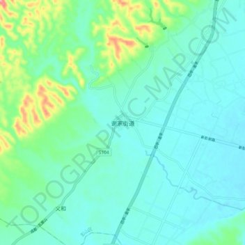
Name: 谢家街道 topographic map, elevation, terrain.
Location: 谢家街道, 彭山区, 眉山市, 四川省, 中国 (30.18533 103.74160 30.26533 103.82160)
Average elevation: 458 m
Minimum elevation: 429 m
Maximum elevation: 573 m
Other topographic maps
Click on a map to view its topography, its elevation and its terrain.