
浈江区 topographic map
Interactive map
Click on the map to display elevation.
About this map
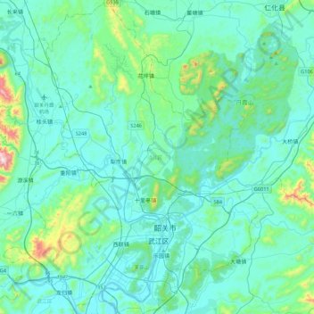
Name: 浈江区 topographic map, elevation, terrain.
Location: 浈江区, 韶关市, 广东省, 512005, 中国 (24.70553 113.42812 25.09672 113.72001)
Average elevation: 151 m
Minimum elevation: 41 m
Maximum elevation: 923 m
Other topographic maps
Click on a map to view its topography, its elevation and its terrain.