
忠信镇 topographic map
Interactive map
Click on the map to display elevation.
About this map
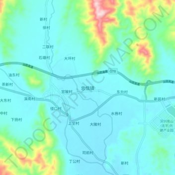
Name: 忠信镇 topographic map, elevation, terrain.
Location: 忠信镇, 河源市, 广东省, 中国 (24.17667 114.69333 24.25667 114.77333)
Average elevation: 196 m
Minimum elevation: 124 m
Maximum elevation: 549 m
Other topographic maps
Click on a map to view its topography, its elevation and its terrain.