
古城镇 topographic map
Interactive map
Click on the map to display elevation.
About this map
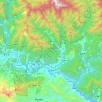
Name: 古城镇 topographic map, elevation, terrain.
Location: 古城镇, 平武县, 绵阳市, 四川省, 中国 (32.31761 104.57162 32.51709 104.75431)
Average elevation: 1,479 m
Minimum elevation: 741 m
Maximum elevation: 3,406 m
Other topographic maps
Click on a map to view its topography, its elevation and its terrain.