
泗耳藏族乡 topographic map
Interactive map
Click on the map to display elevation.
About this map
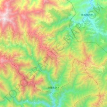
Name: 泗耳藏族乡 topographic map, elevation, terrain.
Location: 泗耳藏族乡, 平武县, 绵阳市, 四川省, 中国 (32.22096 103.88963 32.43201 104.21723)
Average elevation: 2,472 m
Minimum elevation: 1,161 m
Maximum elevation: 4,719 m
Other topographic maps
Click on a map to view its topography, its elevation and its terrain.